From 2015 to 2021, BFI hosted a project called Building Equitable and Inclusive Food Systems at UC Berkeley. The project brought together active collaborators from across campus to help bridge the gaps between food and justice within our campus community.
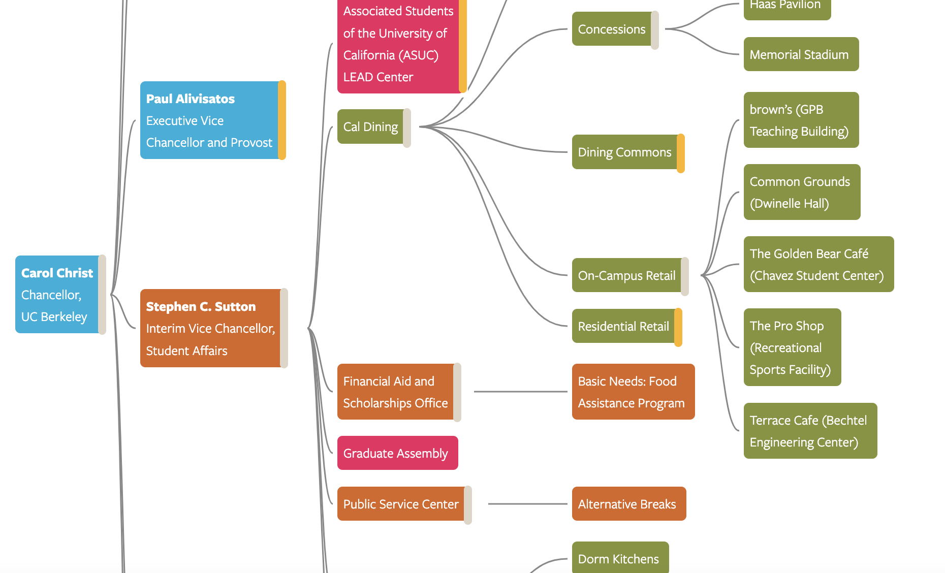
Through a series of workshops aimed at developing emotional intelligence and a more comprehensive understanding of issues of privilege, race, class, gender, sexuality, and other forms of marginalization in food research, teaching, operations, and activism on campus, project leaders learned that the biggest barrier to changing our campus food system was understanding the system itself: all the players, individual and departmental decision-makers, and how different parts of the campus food landscape (“foodscape”) interact.
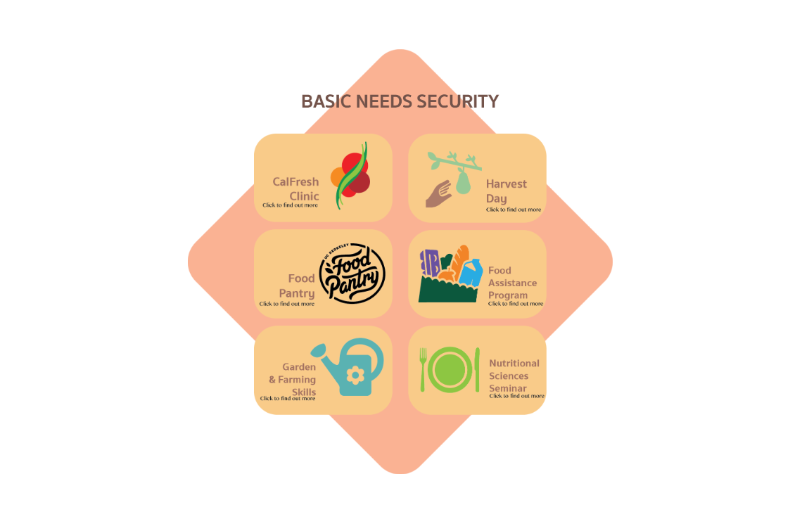
Given those findings, project collaborators came together to begin the creation of the dynamic “Foodscape Map” that aims to both reveal barriers to the full participation of historically marginalized community members in food-related learning and practice on campus — encompassing (but not limited to) teaching, research, student organizations and activism, administrative decisions and initiatives, support services, campus gardens, and dining services, eateries, catering, and other procurement — and highlight opportunities and successes in overcoming such obstacles.